
Walk the Searcy Street Directory
A sound Searcy street directory search separates land ownership from occupancy. Begin with one normalized address. Keep the house number, direction, street name, and suffix in separate notes because county tools may treat them as distinct fields. The parcel number and legal description then become the durable links among the assessment roll, map, deed index, and city files. A legal description identifies the land by subdivision, lot, block, or surveyed bounds, even if a road label changes.
The order matters. Jumping from a name to a whole block can merge people who share initials or mailing addresses. Moving from the address to the parcel first keeps the inquiry tied to one tract.
- Search the exact address in the White County property system. Save the parcel number, physical location, listed owner, owner mailing address, and legal description.
- Open the county parcel map. Match the map popup to the saved parcel number, then inspect the tracts that line the same street.
- Use the legal description in the recorder index. Find the current owner's acquisition deed and note the grantor, recording date, instrument number, and book and page.
- Check Searcy permit, inspection, and code records by address. These date work at the property but may name an applicant or contractor rather than an occupant.
- For older clues, ask the library about reverse directories, then pair maps, census schedules, newspaper microfilm, and deeds. VoterView is only for verifying a supplied identity.
This flow turns the street address into evidence that can be checked. It does not turn an owner roll into a household roll.
Search Searcy Street Property Records
The White County property research screen accepts owner and address clues and links a Searcy location to its assessment record. Search with less text when a full street form fails. The related actDataScout help recommends leaving off street type and, for a whole-street pass, leaving Street Number blank. Directional prefixes and city spelling can split results, so repeat a weak search with variants.
The captured property-search screen shows the public entry point used for address work.
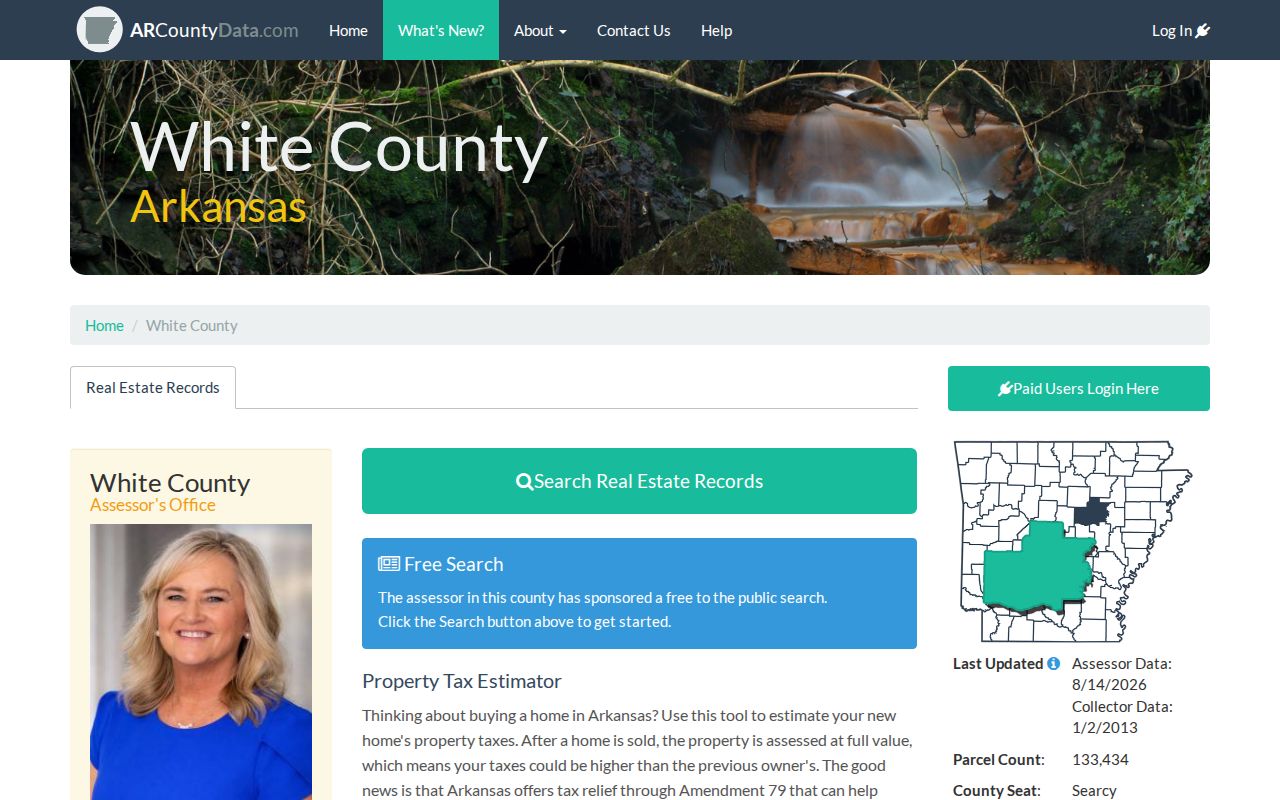
That screen is the first bridge from a street label to a parcel record, not a list of all residents.
| Property field | Input type | Required | Useful practice |
|---|---|---|---|
| County | Selector | Yes | Choose White County before searching |
| Name | Text | No | Try surname and spelling variants |
| Address | Text | No | Normalize direction and omit street type if needed |
| Parcel number | Text | No | Use as the strongest exact key |
| Exact spelling | Option | No | Turn off when the street yields no result |
A parcel card may show owner, mailing and situs addresses, legal description, values, acreage, sales, building traits, sketches, photos, and a homestead indicator. Situs means the physical place being taxed. A matching owner mailing address and situs can support an owner-occupancy inference, but it still does not prove who else lives there.
Map Searcy Streets Parcel by Parcel
The White County parcel map adds the street setting that a row of search results cannot show. Search or pan to the target, click its polygon, and compare the popup identifier with the assessment parcel. Then click each tract along the road. Alleys, corner lots, and large rear parcels can make a visually close property different from a legally adjoining one.
The saved GIS view places the Searcy street directory search in parcel context.
The visible parcel shapes help define the block, while the assessor remains the source for owner and mailing fields.
Map controls may include Search, Layers, Basemap, Zoom, Identify, Measure, and Select or Filter. Some tools depend on the live configuration. Parcel, road, municipal-boundary, district, and flood layers can help explain why two nearby addresses fall under different offices. JavaScript or WebGL may be required. When the viewer fails, use the free Arkansas GIS download or ask the Assessor for the parcel identifier rather than guessing from the map.
- Parcel
- A mapped tract used for assessment. One mailing address may touch more than one parcel.
- Situs address
- The physical location of the taxed property, distinct from the owner's mailing destination.
- Plat
- A recorded survey map that names subdivisions, lots, blocks, streets, and easements.
- Criss-cross directory
- A directory arranged by street and house number rather than only by surname.
Searcy Street Records Side by Side
No source covers the full Searcy street directory question. The strongest approach gives each record a narrow role, notes its access route, and preserves its caveat. Online access is only one channel. White County offices, Searcy departments, the library, and archival collections remain essential when a portal stops at an unknown date or never offered public browsing.
| Address record | Local keeper | What it can show | Access route |
|---|---|---|---|
| Assessment roll | White County Assessor | Owner, mailing and situs addresses, parcel, values | ARCountyData, office help, or bulk FOIA data |
| Parcel map | White County and Arkansas GIS | Boundaries, nearby tracts, configured layers | Free ArcGIS viewer or state download |
| Deeds and plats | Circuit Clerk and Recorder | Legal owners, transfers, legal description | Paid TitleSearcher, clerk counter, phone, books, or copies |
| Voter record | Secretary of State and County Clerk | Matched registration and precinct details | VoterView with identifying inputs or approved extract request |
| Permits and code files | Searcy Planning and Code Enforcement | Applications, work dates, inspections, complaints | Forms, complaint interface, email, or narrow records request |
| Historical address sources | Library, archives, Historical Society | Subscribers, households, structures, notices | In person, staff inquiry, microfilm, catalog, or digital map |
The White County Assessor at 119 W. Arch can assist when the web search does not resolve a parcel. Its official bulk-data sheet offers monthly CAMA extracts for $30 without sketches or photos and $50 with them; the requester supplies media, prepaid return mailer, and payment. That path can support a careful owner list for a whole street, but it still cannot identify renters or all household members.
Note: Keep the date of every download because assessment, mapping, deed, permit, and voter systems update on different schedules.
Turn Searcy Street Addresses into Deeds
A street number alone is weak deed-index input. Start with the current parcel's subdivision, lot and block or its metes-and-bounds wording. Then use the TitleSearcher land-record search to look for the owner's acquisition document by grantee name, instrument number, book and page, subdivision, or legal description. White County coverage is reported from 1885 forward, with validated indexes and images from January 1, 1998 forward.
The captured search interface shows the available routes into recorded instruments.
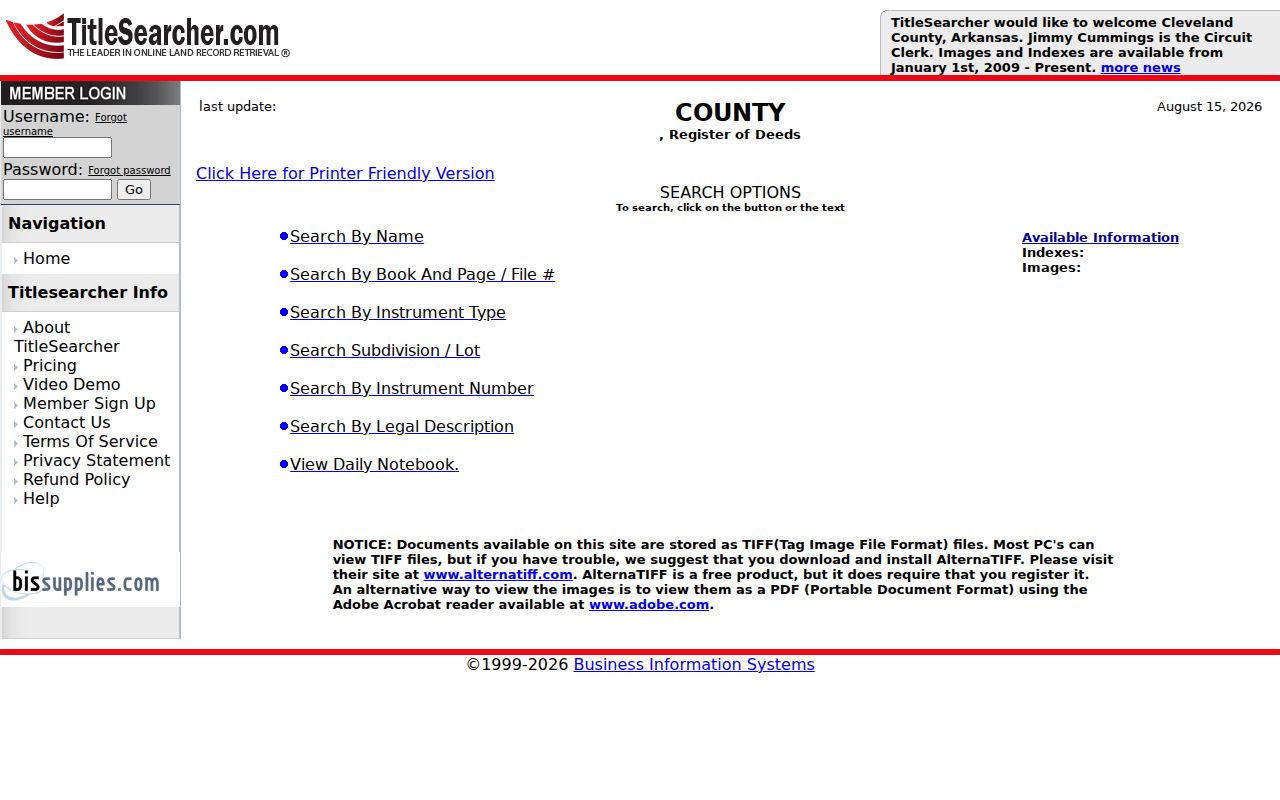
Its name and legal-description modes let the street search continue even when an address has changed.
Grantor means the party transferring an interest; grantee means the party receiving it. Record the current deed's grantor, then search that person as a grantee in an earlier range. Repeat while the legal description remains consistent. The portal lists White County in a $70 monthly tier. General pay-as-you-go terms begin with a $5 deposit, charge $2 per image and $0.25 per opened name, and expire dormant funds under the published rules.
For pre-1998 images or a missed hit, call the White County Circuit Clerk at 501-279-6203. Ask whether the needed item is in an older portal mode, a direct grantor book, a reverse grantee book, a deed book, or microfilm. The counter at the White County courthouse complex is the record authority. A deed proves a legal transaction, not every person in the home.
Date Searcy Addresses with Permits
Searcy permit files can place construction, demolition, fences, signs, street cuts, floodplain work, and inspections at an address. They can also name an applicant or contractor. Those names explain who handled the work, not who occupied the property. No complete public permit-search database or official online cutoff was found, so the fallback chain should lead the search.
The Searcy permits and inspections page supplies forms and requirements for the record series.
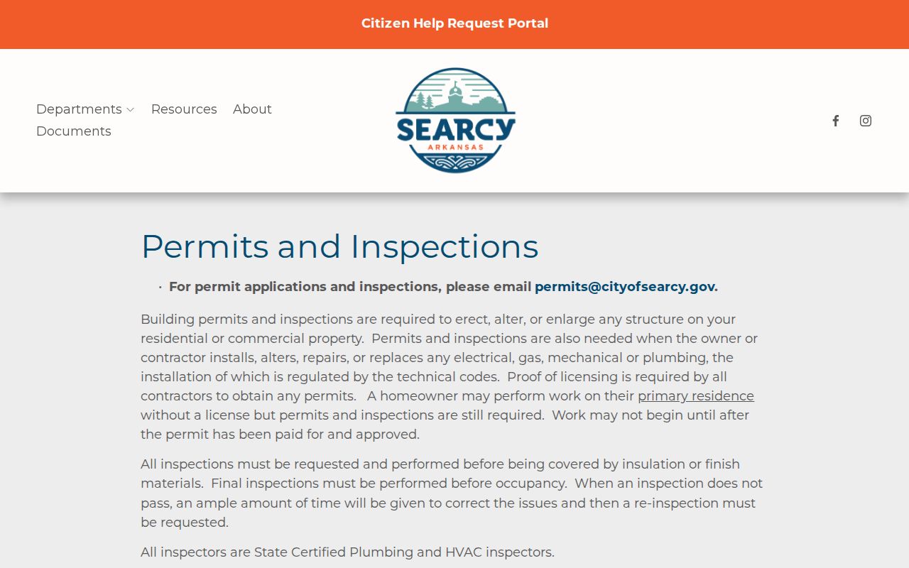
Its form list helps name the exact permit type when requesting an address file.
Contact Planning and Development at 300 W. Arch, 501-279-1085, or permits@cityofsearcy.gov. Give the address, parcel, permit type, and date range. Engineering at 1615 Eastline Road, 501-279-1092, may hold street or infrastructure material. Arkansas FOIA supports a narrow request for existing, nonexempt files through the responsible custodian. Ask for the releasable portion if a file also contains protected facts.
Searcy Code Records by Street
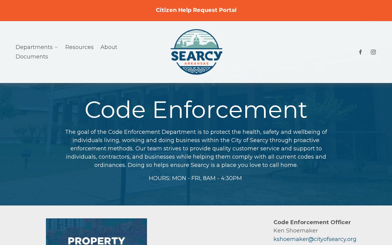
The city zoning code calls for retention of issued and denied permits, certificates of occupancy, violation complaints, and actions taken. The Searcy Code Enforcement page links both reporting and complaint-search tools, although the live field list was not captured. Search by the address if the interface permits it, then use the city request route for the underlying releasable record.
The saved city screen marks the official complaint-search entry for a Searcy street directory inquiry.
A complaint is an allegation tied to a place. The retained action record is needed to learn how the city handled it.
Do not infer a resident's identity from the complainant, applicant, or owner field. City departmental files connect an address to civic activity. They do not create a full occupant directory.
VoterView Is No Street Directory
Arkansas VoterView verifies a supplied person through first name, last name, date of birth, and county. It may return registration status, county, precinct, polling site, districts, and ballot information. It does not allow open browsing down a Searcy street. A non-match can reflect spelling, a recent update, an inactive status, or wrong identifiers, so it does not prove that a person left an address.
For an authorized broader need, the Secretary of State's written voter-data instructions describe VR, VH, and combined VRVH files. The request identifies the requester, dataset, format, delivery details, and acceptance of restrictions. Protected fields and secure-voter addresses are excluded. Vote history means participation, never ballot choice. The White County Clerk at 315 N. Spruce, 501-279-6204, is the local registrar and the right office for a legitimate access question.
Key limit. VoterView is identity verification, not a public by-street resident list, and protected addresses must never be reconstructed from other sources.
Read Historic Searcy Street Evidence
Modern parcel tools stop short of the older household trail. The Searcy Public Library Arkansas Room holds Daily Citizen microfilm from July 1953, pre-1920 White County marriage material, local family histories, White County Heritage, and HeritageQuest. Call 501-268-2449 before visiting to confirm reader access and ask whether any telephone or reverse directory can be scanned. No verified catalog disclosed a complete Searcy city-directory run, so missing years must stay marked as gaps.
For older blocks, the Library of Congress Sanborn collection includes Searcy editions from 1886, 1892, 1896, 1901, 1908, 1913, and 1919. The maps show structures, street labels, and land use, not occupants. A street name or number can be stabilized with the map, then tested against a deed, census, newspaper, or a verified directory volume.
The full historical shelf and its reading method belong in the Searcy Directory Book discussion. For address work, copy the title page and abbreviation key before treating any old entry as proof.
Postal Searcy Differs from City Limits
A Searcy mailing label does not settle legal jurisdiction. Postal Searcy, incorporated Searcy, and White County service areas overlap but are not identical. Confirm the standardized address with USPS, then check the parcel and the Arkansas GIS “Check My City” tool. City permits follow municipal jurisdiction, while county assessment and deeds follow the parcel. This geographic split explains why a street search may find county land records but no Searcy permit file.
The city is also the seat of White County, not Searcy County. Searcy County is a different Arkansas jurisdiction. Catalog and archive searches should combine “Searcy,” “White County,” and “Arkansas” to avoid pulling the wrong court books or maps.
Note: ZIP labels route mail; parcel and municipal records determine which local custodian holds an address file.
Check Searcy Tax Status Separately
Assessment and collection are separate. The Assessor describes the property and value; the Collector handles current and delinquent tax accounts. The White County Collector page links tax-payment and assessment resources.
The captured Collector screen gives the official route for tax-account questions.

Use that source for payment status rather than relying on an old collector-data date shown beside a current assessment record.
Searcy Records Enter a New Cycle
White County's assessor says the county will move from a five-year to a four-year reappraisal cycle beginning January 1, 2027. TASC has handled reappraisal since 2015. Reappraisal changes the pace of field review and assessed-value updates, not legal deed ownership. A fresh value date should therefore be read beside the last recorded instrument rather than mistaken for a transfer date.
This timely change also makes capture dates important. The property portal, parcel map, and recorder index may reflect different update days. Save each source date with the parcel number and legal description so the Searcy street directory trail can be repeated later.
Limits of a Searcy Street Directory
A public street directory can show owners, parcel boundaries, deed parties, dated city work, and restricted forms of voter evidence. It cannot establish every adult, child, renter, guest, or family relationship at an address. Utility customer data should not be assumed open. Motor-vehicle address data is protected by federal law. An owner mailing address may belong to an agent, trust, business office, or former address.
Use two independent facts before tying a person to a Searcy parcel. Label each conclusion as owner, registrant, deed party, permit applicant, subscriber, or enumerated household member. Those roles are not interchangeable.
Lawful use. Searcy address records are for lawful personal, family-history, property, and civic research. Never use them to stalk, threaten, harass, or defeat a protected address.
When a record matters, verify it with the office that keeps it. The White County Circuit Clerk and Recorder is authoritative for deeds, the Assessor for parcel data, and Searcy departments for their own files.